

Satellite Finder - Dish Pointer
nabil fawzi
คำอธิบายของSatellite Finder - Dish Pointer
satellite director dish & satfinder app (Satellite Finder) is a tool which will help you to set up your dish tv
satellite It will give you azimuth, elevation and LNB tilt for your directv location (based on GPS) and on the
chosen satellite from list The result is shown both as numeric data and graphical on google maps.
It has also built in compass which will help you to find proper satellite azimuth. It also can use augmented reality to sat tv show where is satellite map on camera view.
Find a TV antenna or a satellite, in azimuth, can be pretty hard. Before but you can find easily with a compass, magnetic variation compass azimuth and azimuth of the satellite.
Satellite Director replaces all that.
How this app works :
- The azimuth, height and skew edge is figured for your area and picked satellite guide. Under ascertained qualities there is a compass with graphical portrayal of azimuth edgeThe azimuth point is ascertained with attractive tendency Keep in mind each time you utilize compass
you ought to align it.
Green line speaks to your telephone azimuth So if on compass green and red markers are on each other front of the telephone should indicate you heading to the satellite director. locator If the compass esteem is right – telephone azimuth esteem will practice environmental safety.
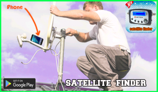
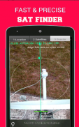
Just enable the GPS in your phone or enter your GPS position, select the desired TV satellite and point your phone to the sky to target (find) the TV satellite. You found the satellite when the white ball is in the white circle and the cyan ball is in the cyan circle. Align, azimuth, the offset arm of the satellite dish to the cyan arrow on the screen phones and the dish is aligned in azimuth with the satellite.
In the event that application discovered your area, you should choose satellite definition wanted satellite director. To do this you should discover symbol with amplification glass and tap it. On the rundown you will discover all satellites director with rise point over zero degrees. Keep in mind: satellite guide name doesn't influence the computation of edges. Imperative thing is satellite director position.
ผู้อำนวยการจานดาวเทียมและแอป satfinder (เครื่องมือค้นหาดาวเทียม) เป็นเครื่องมือที่จะช่วยคุณในการติดตั้งจานทีวีของคุณ
ดาวเทียมจะให้มุมเอียงสูงและความลาดเอียงของ LNB สำหรับตำแหน่ง directv ของคุณ (อิงตาม GPS) และบน
ดาวเทียมที่เลือกจากรายการผลที่ได้จะแสดงเป็นข้อมูลตัวเลขและกราฟิกบน Google Maps
มันยังสร้างขึ้นในเข็มทิศซึ่งจะช่วยให้คุณหา azimuth ดาวเทียมที่เหมาะสม นอกจากนี้ยังสามารถใช้ความเป็นจริงเติมเพื่อนั่งรายการโทรทัศน์ที่มีแผนที่ดาวเทียมในมุมมองกล้อง
หาเสาอากาศทีวีหรือดาวเทียมในแนวรถอาจเป็นเรื่องยาก ก่อนหน้านี้ แต่คุณสามารถหาได้ง่ายด้วยเข็มทิศเข็มทิศเข็มทิศแม่เหล็กและรัศมีของดาวเทียม
กรรมการดาวเทียมแทนที่ทั้งหมดที่
วิธีการทำงานของแอปนี้:
- มีทิศตะวันตกเฉียงเหนือความสูงและขอบเอียงสำหรับพื้นที่ของคุณและเลือกคู่มือดาวเทียม ภายใต้คุณภาพที่แน่นอนมีเข็มทิศที่มีภาพวาดของขอบของ azymut ขอบของ azymut คือ ascertained มีแนวโน้มที่น่าสนใจเก็บไว้ในใจทุกครั้งที่คุณใช้เข็มทิศ
คุณควรจัดตำแหน่งให้สอดคล้อง
สายสีเขียวพูดถึง azimuth โทรศัพท์ของคุณดังนั้นถ้าบนเข็มทิศเครื่องหมายสีเขียวและสีแดงอยู่ในด้านหน้าอื่น ๆ ของโทรศัพท์ควรระบุว่าคุณมุ่งหน้าไปยังผู้อำนวยการดาวเทียม locator หากความนับถือเข็มทิศถูกต้อง - ความเคารพนับถือทางโทรศัพท์จะปฏิบัติด้านความปลอดภัยต่อสิ่งแวดล้อม
เพียงเปิดใช้งาน GPS ในโทรศัพท์ของคุณหรือป้อนตำแหน่ง GPS เลือกดาวเทียมทีวีที่ต้องการและชี้โทรศัพท์ไปยังท้องฟ้าเพื่อกำหนดเป้าหมาย (ค้นหา) ทีวีดาวเทียม คุณพบดาวเทียมเมื่อลูกบอลสีขาวอยู่ในวงกลมสีขาวและลูกสีฟ้าอยู่ในวงกลมสีฟ้า จัดตำแหน่งมุมฉากแขนหักแขนของจานรับสัญญาณดาวเทียมให้กับลูกศรสีฟ้าบนโทรศัพท์หน้าจอและจานจะเรียงกันในแนวราบกับดาวเทียม
ในกรณีที่แอปพลิเคชันค้นพบพื้นที่ของคุณคุณควรเลือกข้อกำหนดดาวเทียมต้องการให้ผู้อำนวยการดาวเทียม เมื่อต้องการทำเช่นนี้คุณควรจะค้นพบสัญลักษณ์ที่มีกระจกขยายและเคาะ ใน rundown คุณจะพบผู้กำกับดาวเทียมทั้งหมดที่มีจุดสูงกว่า 0 องศา โปรดทราบ: ชื่อคู่มือดาวเทียมไม่มีผลต่อการคำนวณขอบ สิ่งที่จำเป็นคือตำแหน่งผู้อำนวยการดาวเทียม


